Imagine a world where crops are monitored with precision, pests are targeted with accuracy, and yields are optimized effortlessly. Well, thanks to the remarkable technological advancements in recent years, this is no longer a distant dream. Drones, those fascinating unmanned aerial vehicles, have swiftly made their mark in the agricultural industry, offering farmers a plethora of benefits. From aerial mapping to crop health assessment, these agile machines are revolutionizing the way we approach agriculture. Discover the incredible ways in which drones are transforming the farming landscape, and witness firsthand the unrivaled potential they hold for the future.
Reducing Crop Monitoring Time
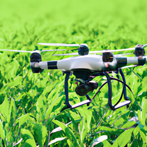
Real-Time Monitoring
Drones are revolutionizing the world of agriculture by providing real-time monitoring capabilities. With the use of drones, you can now monitor your crops from the comfort of your own home. Drones equipped with high-resolution cameras and sensors can capture images and data of your fields, allowing you to remotely assess the health and condition of your crops. This eliminates the need for manual inspection, saving you time and effort.
Early Detection of Crop Diseases
One of the key benefits of using drones in agriculture is their ability to detect crop diseases at an early stage. By regularly flying drones over your fields, you can identify any signs of diseases such as fungal infections, bacterial infections, or viral infections. Drones can capture detailed images of your crops, which can then be analyzed using specialized software to identify any abnormalities or patterns indicative of diseases. Early detection allows you to take timely action and implement appropriate measures to prevent the spread of diseases, ultimately increasing your crop yield and minimizing losses.
Identification of Nutrient Deficiencies
Drones can also help you identify nutrient deficiencies in your crops. By capturing imagery of your fields and using sophisticated algorithms, drones can analyze the color and reflectance of your crops to determine their health status. This analysis can reveal any nutrient deficiencies, such as lack of nitrogen, phosphorus, or potassium. By identifying these deficiencies early on, you can take corrective measures such as adjusting your fertilizer application or implementing precision farming techniques to ensure optimal nutrient levels in your crops. This leads to healthier plants with higher yields.
Enhancing Precision Farming
Accurate Mapping of Farmland
Precision farming is all about optimizing resources and maximizing crop productivity. Drones play a crucial role in this process by providing accurate mapping of farmland. With their high-resolution cameras and GPS capabilities, drones can create detailed maps of your fields, capturing important information such as topography, soil composition, and vegetation indices. This data can then be utilized to create precise field boundaries, identify areas of variability, and create prescription maps for targeted farming practices, such as variable rate applications of fertilizers and pesticides.
Targeted Irrigation and Fertilization
Drones enable targeted irrigation and fertilization, which is essential for efficient resource management. By analyzing the data collected from drones, you can identify areas in your fields that require specific attention. For example, if a particular area is identified as having low soil moisture levels, drones can be used to accurately apply water to that specific area, reducing water waste and ensuring optimal plant growth. Similarly, drones can provide precise application of fertilizers, minimizing nutrient runoff and pollution, while maximizing nutrient uptake by the crops. This targeted approach improves crop health and reduces the overall input costs.
Weed and Pest Control
Managing undesirable weeds and pests is a major challenge in agriculture. Drones equipped with specialized imaging systems can help in the early detection and control of weeds and pests. By flying drones over your fields, you can identify weed-infested patches or areas with pest populations. This information can then be used to implement targeted interventions such as spot-spraying herbicides or releasing beneficial insects. Drones can even be equipped with spraying systems to apply pesticides or herbicides directly to the affected areas, reducing the overall use of chemicals and minimizing the impact on the environment.
Improving Crop Health and Yield
Monitoring Soil Conditions
Soil is the foundation for healthy crop growth, and monitoring its condition is crucial for optimal plant health and yield. Drones equipped with advanced sensors can collect data on key soil parameters such as moisture levels, nutrient content, and pH. This data is then analyzed to provide valuable insights into the soil health of your fields. By regularly monitoring soil conditions, you can make informed decisions regarding irrigation, fertilization, and soil amendments, ensuring that your crops have the ideal growing environment. This leads to improved crop health, increased yield, and reduced input costs.
Identification of Crop Stress Factors
Crop stress factors such as water stress, nutrient deficiencies, or disease infestations can significantly impact crop health and yield. Drones can help in the early identification of such stress factors by capturing high-resolution images of your fields. By analyzing the data collected by drones, you can detect areas of your fields where crops are experiencing stress. This information allows you to diagnose the underlying causes and take immediate action to mitigate the stress factors. Timely interventions can range from adjusting irrigation schedules to applying specific nutrients or implementing pest control measures, ultimately improving the health and productivity of your crops.
Optimization of Crop Management Practices
By providing valuable data and insights, drones enable you to optimize your crop management practices. The information collected by drones can be analyzed using advanced algorithms and integrated with other agricultural data sources, such as weather data and crop growth models. This integration allows you to make data-driven decisions regarding planting schedules, crop rotation strategies, and pest management practices. The optimization of crop management practices based on accurate and timely data leads to increased efficiency, reduced input costs, and improved crop yields.
Assessing Field Conditions
Drought Assessment
Droughts can have a devastating impact on agriculture, leading to crop losses and reduced yields. Drones can help in the assessment of drought conditions by capturing high-resolution images of your fields. By analyzing these images, you can identify areas that are experiencing water stress and plan appropriate irrigation strategies. Drones can also monitor the effectiveness of drought mitigation measures, such as the use of cover crops or the implementation of water-saving techniques. This real-time assessment of drought conditions allows you to take proactive measures to minimize crop losses and optimize water usage.
Flood Damage Evaluation
Floods can cause significant damage to crops, infrastructure, and soil. Drones provide a valuable tool for evaluating flood damage in agricultural areas. By flying drones over your fields, you can capture detailed imagery of the flooded areas, allowing you to assess the extent of the damage. This information enables you to prioritize recovery efforts, such as soil remediation or replanting, in the most affected areas. Drones can also be used to monitor the progress of recovery efforts and evaluate the effectiveness of mitigation measures. The timely evaluation of flood damage using drones helps in minimizing crop losses and facilitating the recovery process.
Soil Erosion Detection
Soil erosion is a major concern in agriculture, leading to loss of topsoil and reduced soil fertility. Drones equipped with high-resolution cameras can capture imagery that reveals signs of soil erosion, such as gullies or exposed roots. By analyzing these images, you can identify vulnerable areas in your fields and take appropriate soil conservation measures. These measures may include contour plowing, terracing, or the implementation of cover crops. Regular monitoring of soil erosion using drones helps in preserving soil health, ensuring sustainable crop production, and minimizing the negative impacts of erosion on the environment.
Analyzing Plant Health
Thermal Imaging for Stress Detection
Thermal imaging technology allows drones to detect crop stress factors that are not visible to the naked eye. By capturing thermal images of your fields, drones can identify variations in temperature that indicate areas of stress. For example, areas experiencing water stress or disease infections may show different temperature patterns compared to healthy areas. By analyzing these thermal images, you can pinpoint the areas that require immediate attention, such as adjusting irrigation or applying appropriate treatments. Thermal imaging combined with other data sources enhances your ability to monitor plant health and make informed decisions to optimize crop yield.
Estimation of Chlorophyll Content
Chlorophyll is a vital pigment for plant growth and photosynthesis. Drones equipped with specialized cameras can estimate the chlorophyll content of your crops, providing valuable insights into their health and development. By capturing images of your fields and analyzing the reflectance of different light wavelengths, drones can calculate the chlorophyll content and vegetation indices. These indices can then be used to assess the physiological status of your crops and detect any potential problems such as nutrient deficiencies or disease infections. Estimating chlorophyll content using drones helps in optimizing fertilization strategies and ensuring optimal plant health.
Identification of Plant Diseases
Plant diseases can have a significant impact on crop health and yield. Drones equipped with high-resolution cameras and sensors can capture detailed images of your crops, enabling the detection and identification of plant diseases at an early stage. By analyzing these images using specialized software, you can identify the presence of fungal infections, viral infections, or bacterial infections. Early detection allows you to implement timely treatments or preventive measures, such as the application of fungicides or the removal of infected plants. The use of drones for disease identification improves crop health and minimizes yield losses.
Enhancing Livestock Management
Monitoring Grazing Patterns
Drones are not limited to crop monitoring; they can also be used to enhance livestock management. By flying drones over your pastures, you can monitor the grazing patterns of your livestock. This information allows you to assess the utilization of pasture resources and identify any areas that may be overgrazed or underutilized. By understanding the grazing patterns, you can implement rotational grazing strategies or adjust feed supplementation to ensure optimal utilization of resources and maintain the health and productivity of your livestock.
Counting and Tracking Animals
Drones equipped with thermal or visual sensors can be used to count and track animals. This is particularly useful when managing large herds or when conducting wildlife surveys. With the help of drones, you can accurately count the number of animals in your herd or monitor the movement of wildlife in protected areas. This data assists in tracking animal populations, assessing population dynamics, and making informed decisions regarding herd management or conservation efforts.
Identifying Sick Animals
Detecting signs of illness or injury in livestock is crucial for timely intervention and treatment. Drones can aid in the identification of sick animals by capturing high-resolution imagery that reveals subtle changes in behavior, body condition, or movement patterns. By regularly monitoring your livestock using drones, you can identify individuals that require veterinary attention, isolate them if necessary, and ensure appropriate care. This early identification of sick animals helps in preventing disease outbreaks, minimizing economic losses, and promoting animal welfare.
Increasing Efficiency in Crop Spraying
Precision Application of Pesticides
Applying pesticides to crops is an essential task in agricultural practices. Drones equipped with precision spraying systems enable more efficient and targeted application of pesticides. By utilizing GPS technology and advanced spraying systems, drones can precisely apply pesticides to specific areas or individual plants, reducing chemical waste and minimizing the impact on non-target areas. This precision application not only increases the efficiency of pesticide use but also reduces the overall amount of chemicals required, promoting sustainable farming practices and protecting the environment.
Reduced Environmental Impact
Traditional crop spraying methods often result in the drift of chemicals, leading to pollution of the air, soil, and water. Drones offer a solution to this problem by reducing the environmental impact of crop spraying. With their ability to fly at low altitudes and precise application capabilities, drones minimize chemical drift and ensure that pesticides are applied directly to the intended targets. This reduces the risk of contamination, protects nearby water sources, and minimizes the exposure of non-target organisms to harmful chemicals, contributing to a healthier ecosystem.
Enhanced Crop Protection
Crop protection is essential for preventing yield losses and ensuring the overall health of your crops. Drones equipped with specialized sensors and imaging systems can help in the early detection of pests, diseases, or weed infestations. By accurately identifying these threats, you can implement timely and targeted interventions to protect your crops. This may include the application of pesticides, the release of beneficial insects, or the removal of diseased plants. The use of drones for crop protection enhances the efficiency and effectiveness of these interventions, ultimately leading to improved crop health and increased yields.
Improving Crop Insurance Assessments
Accurate Assessment of Damage
Crop insurance is essential for protecting farmers against potential losses. Drones can play a crucial role in improving the accuracy of crop insurance assessments. By capturing high-resolution aerial imagery of damaged fields, drones can provide insurers with an accurate assessment of the extent and severity of the damage. This information enables insurers to make fair and timely decisions regarding claim settlements, ensuring that farmers receive the appropriate compensation for their losses. Drones provide a cost-effective and efficient solution for crop insurance assessments, eliminating the need for manual inspections and reducing the time required for claim processing.
Rapid Claims Processing
Traditional methods of processing crop insurance claims can be time-consuming and resource-intensive. Drones streamline this process by providing insurers with timely and accurate data. The captured imagery can be analyzed using specialized software, allowing for quick assessments of the damage and potential loss calculations. Drones also assist in verifying claims by providing before-and-after images of the affected fields. This rapid claims processing not only benefits the farmers by speeding up the compensation process but also enables insurers to enhance their operational efficiency and reduce administrative costs.
Effective Risk Management
Drones contribute to effective risk management in the agricultural sector by providing valuable data for risk assessment and mitigation strategies. The information collected by drones, such as field conditions, crop health, and weather patterns, can be integrated with other data sources to analyze and predict potential risks. This data-driven approach allows farmers, insurers, and policymakers to make informed decisions regarding risk management strategies, such as the establishment of insurance pricing models, the implementation of early warning systems, or the development of contingency plans. Effective risk management based on drone data enhances the resilience and sustainability of the agricultural sector.
Enabling Autonomous Agriculture
Autonomous Field Scouting
Autonomous field scouting is made possible with the use of drones. By programming drones to fly pre-defined routes across your fields, you can collect data and imagery of your crops without manual intervention. Drones equipped with intelligent algorithms and sensors can capture high-resolution images, detect anomalies or areas of concern, and transmit this information in real-time. This autonomous field scouting allows you to remotely monitor your crops, identify potential issues, and take timely action, minimizing the need for manual labor and improving operational efficiency.
Automated Planting and Seeding
Planting and seeding are labor-intensive tasks in agriculture. Drones offer a solution by enabling automated planting and seeding operations. Equipped with precision seed dispensers, drones can accurately sow seeds at the desired depth and spacing. By programming drones to follow predetermined flight paths, you can automate the entire process, saving time and reducing labor costs. Automated planting and seeding using drones ensure uniform seed distribution, optimal plant spacing, and increased planting efficiency, ultimately leading to improved crop emergence and higher yields.
Robotic Crop Harvesting
Harvesting is a time-sensitive and labor-intensive process. Drones can assist in robotic crop harvesting by providing real-time data and imagery of your fields. By analyzing this data, you can determine the optimal timing for harvesting, ensuring that crops are harvested at their peak maturity. Drones can also be used to guide autonomous harvesting robots, helping them navigate through the fields and identify the ripe crops. Robotic crop harvesting, enabled by drones, reduces the need for manual labor, increases harvesting efficiency, and minimizes post-harvest losses, resulting in higher productivity and profitability.
Facilitating Data-Driven Decision Making
Integration with GIS and Big Data Analytics
Drones capture vast amounts of data that can be analyzed and integrated with Geographic Information Systems (GIS) and Big Data analytics. By combining drone data with other agricultural data sources, such as soil maps, weather data, or yield records, you can gain a comprehensive understanding of your farming operations. This integration allows you to make data-driven decisions regarding crop planning, resource allocation, and risk management. By combining drone data with advanced analytics, you can uncover valuable insights, identify trends, and optimize your farming practices, leading to increased efficiency and improved profitability.
Data-Driven Crop Planning
Data collected by drones provides valuable information for crop planning. By analyzing the data, you can identify variations in soil composition, moisture levels, or plant health across your fields. This information enables you to make informed decisions regarding crop selection, planting densities, or rotation strategies. By tailoring your crop planning based on accurate and timely data, you can optimize resource allocation, minimize the risk of crop failure, and maximize the overall productivity of your farming operations. Data-driven crop planning enhances your ability to adapt to changing environmental conditions, increase resilience, and improve long-term sustainability.
Predictive Analytics for Yield Optimization
Drones contribute to yield optimization by providing data for predictive analytics. By capturing data on various agronomic factors, such as weather conditions, soil fertility, or plant health, drones enable the development of predictive models that can forecast crop yields. These models can be used to estimate potential yield variations and optimize resource management strategies accordingly. By leveraging predictive analytics, you can adjust your planting schedules, irrigation strategies, or fertilization plans to maximize yield potential. The use of drones and predictive analytics allows you to make proactive decisions and optimize your farming practices for optimal productivity and profitability.
Overall, drones are transforming the agriculture industry by providing comprehensive and real-time monitoring capabilities, enhancing precision farming practices, improving crop health and yield, assessing field conditions, analyzing plant health, enabling livestock management, increasing efficiency in crop spraying, improving crop insurance assessments, facilitating autonomous agriculture, and enabling data-driven decision making. By leveraging drone technology, farmers can optimize their operations, increase productivity, reduce costs, and contribute to sustainable and profitable agriculture.