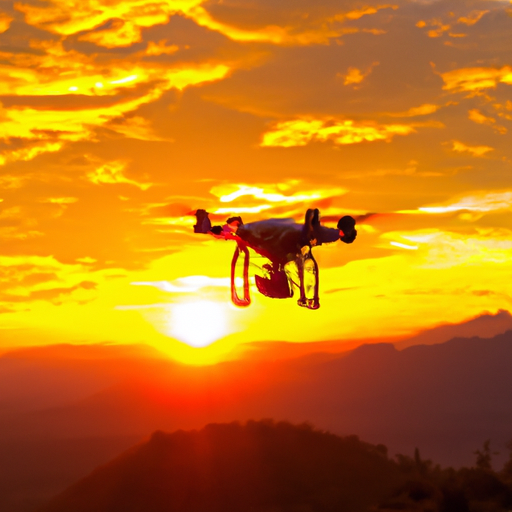
Are you new to the world of drone piloting? If so, then you may be wondering why GPS functionality is crucial for beginners. Well, let me tell you, having GPS on your drone can be a game-changer! With GPS, you can easily track and locate your drone, ensuring that it doesn’t get lost. Not only that, but GPS also provides stability and precision, allowing you to fly your drone with ease and confidence. In this article, we will explore the reasons why GPS functionality is essential for beginner drone pilots. So, buckle up and get ready to soar into the exciting world of drone piloting!
What is GPS functionality?
GPS functionality refers to the use of global positioning system technology in drones to enhance their safety, control, navigational assistance, flight experience, and more. By utilizing GPS technology, drones can accurately determine their own position and navigate themselves in the sky with precision. This feature is especially crucial for beginner drone pilots who are still grasping the basics of drone operation and navigation.
Understanding GPS technology
GPS, or Global Positioning System, is a satellite-based navigation system that provides location and time information anywhere on the Earth’s surface. It works by utilizing a network of orbiting satellites, ground-based control stations, and user receivers. By receiving signals from multiple satellites, the GPS receiver in a drone can determine its exact location in three-dimensional space. This information is then used to assist the pilot in controlling and navigating the drone.
How GPS works in drones
In drones, GPS technology works by utilizing a GPS receiver module integrated into the drone’s flight controller. This module communicates with multiple GPS satellites to receive precise location data. The drone’s flight controller processes this data and makes adjustments to the drone’s flight path, allowing for accurate positioning, navigation, and control. With GPS functionality, beginner drone pilots can rely on the technology to assist them in flying their drones safely and efficiently.
Safety and Control
Preventing accidents and crashes
GPS functionality plays a significant role in preventing accidents and crashes for beginner drone pilots. With GPS technology, drones can automatically maintain their position and altitude, making it easier for pilots to control them. The GPS receiver constantly provides accurate data on the drone’s location, which allows the flight controller to make necessary adjustments to ensure the drone stays within the specified flight boundaries. This helps prevent the drone from straying into restricted or dangerous areas, reducing the risk of accidents and crashes.
Maintaining stability and control
Another benefit of GPS functionality is its ability to help maintain stability and control during flight. GPS-equipped drones can utilize the data provided by satellites to calculate their speed, direction, and orientation. This allows the flight controller to make real-time adjustments to ensure that the drone remains stable and responsive to the pilot’s commands. For beginner drone pilots who may struggle with maintaining stability, GPS functionality provides an added layer of support to ensure smooth and controlled flights.
Return-to-home feature
One of the most valuable safety features enabled by GPS functionality is the return-to-home feature. In case of a signal loss or low battery situation, the drone can automatically return to its takeoff location using GPS waypoints. This feature provides peace of mind for beginner drone pilots, as they know that their drone will autonomously return to a safe location even if they lose control or encounter unexpected issues. The return-to-home feature is particularly useful when flying in unfamiliar or challenging environments, ensuring the drone’s safe return.
Navigational Assistance
Precise location tracking
GPS functionality allows beginner drone pilots to benefit from precise location tracking capabilities. With accurate GPS positioning, pilots can easily track their drone’s location on a map or display, both horizontally and vertically. This information helps pilots to understand where their drone is in relation to their own position, enhancing situational awareness and reducing the risk of losing track of the drone during flight. Precise location tracking also aids in retrieving a drone in case it becomes lost or stuck in a difficult-to-reach location.
Waypoint navigation
Waypoint navigation is a powerful navigational feature enabled by GPS functionality. It allows pilots to set specific points on a map or display, defining the drone’s desired flight path. Once the waypoints are set, the drone can autonomously follow the predefined route without constant input from the pilot. This feature is incredibly useful for beginner drone pilots who may struggle with manually controlling the drone’s flight path. By utilizing waypoint navigation, pilots can focus on capturing photos or videos without having to worry about steering the drone along the desired path.
Automatic flight modes
GPS functionality unlocks various automatic flight modes that can greatly assist beginner drone pilots. These modes include follow-me, orbit, and waypoints, among others. Follow-me mode allows the drone to automatically track and follow the pilot, keeping them in frame and capturing dynamic footage. Orbit mode allows the drone to autonomously circle around a specific point of interest, capturing smooth and synchronized footage. Waypoint mode enables the drone to fly along a preplanned route, performing specific actions at each waypoint. These automatic flight modes provide an enhanced flight experience for beginner pilots, allowing them to capture professional-level shots easily.
Enhanced Flight Experience
Improved flight planning
GPS functionality enhances the flight planning process for beginner drone pilots. By leveraging satellite data, drones can access accurate maps and aerial imagery, providing pilots with valuable insights into their intended flight areas. This enables pilots to plan their routes effectively, avoiding potential obstacles, such as buildings, power lines, or restricted airspace. With improved flight planning, beginner pilots can ensure safer and more efficient flights, minimizing the chances of accidents and maximizing the quality of their aerial footage.
Real-time data on altitude and speed
GPS-enabled drones provide real-time data on altitude and speed to the pilot. This information is crucial for maintaining control and ensuring safe flight operations. Beginner drone pilots can monitor the drone’s altitude to prevent it from flying too low or venturing into restricted airspace. Additionally, real-time speed data allows pilots to adjust their flying speed to match their desired shots or terrain conditions. By having access to accurate and up-to-date altitude and speed information, pilots can confidently navigate their drones and achieve their intended flight objectives.
Geo-fencing capabilities
Geo-fencing is a valuable feature made possible by GPS functionality. It allows pilots to establish virtual boundaries or no-fly zones in specific geographic areas. With the help of GPS technology, drones can detect when they approach or enter these restricted zones and automatically adjust their flight path to avoid them. This is particularly important for beginner drone pilots who may not be familiar with all the legal restrictions and safety considerations of a particular location. Geo-fencing capabilities give pilots peace of mind, knowing that their drones will adhere to the prescribed boundaries, ensuring compliance with regulations and minimizing the risk of accidents or unauthorized flights.
Beginner-Friendly Features
Assisted takeoff and landing
For beginner drone pilots, the process of taking off and landing a drone can be intimidating and challenging. GPS functionality solves this problem by providing assisted takeoff and landing features. With these features, the drone can autonomously handle the initial ascent and descent phases, ensuring a smooth and stable operation. This frees up beginners from worrying about precise control during these critical moments, allowing them to focus on mastering other aspects of drone flight.
Auto-hover functionality
Auto-hover functionality is another valuable feature that GPS-equipped drones offer for beginners. When activated, this feature allows the drone to hold its position and hover in the air without any input from the pilot. This is particularly helpful when beginners need to pause and assess the situation or capture steady footage. Auto-hover ensures that the drone remains stable in the desired location, without drifting or veering off course. This feature gives beginner pilots the confidence and control they need to experiment with different camera angles or focus on other creative aspects of aerial photography or videography.
Geographical restrictions awareness
Drone flights are subject to geographical restrictions and regulations. For beginner drone pilots, it can be challenging to keep track of all the no-fly zones and airspace restrictions. GPS functionality helps address this issue by providing geographical restrictions awareness. Drones with this feature can access up-to-date information on restricted areas, ensuring that pilots are aware of any airspace restrictions or legal requirements in their vicinity. This empowers beginner pilots to fly within the boundaries of the law, minimizing the risk of encountering legal issues or compromising safety.
Geotagging and Image Localization
Adding geographical tags to photos/videos
Geotagging is a feature that utilizes GPS functionality to add geographical coordinates or location information to the metadata of photos or videos captured by the drone. This feature allows pilots to precisely document the location where each shot was taken. Geotagged media can be easily organized, sorted, and shared, providing a valuable reference for future use or documentation purposes. For beginner drone pilots, geotagging simplifies the process of cataloging their aerial footage, making it easier to find and showcase their best shots.
Precise location of aerial shots
In addition to geotagging, GPS functionality also enables the precise determination of the location where aerial shots were taken. This information allows beginner pilots to recreate specific flight paths or revisit locations of interest accurately. Precise location data assists pilots during post-flight analysis or when planning follow-up flights in the same area. By knowing the exact location of their aerial shots, beginner drone pilots can better align their creative vision and explore different angles or perspectives for future projects.
Emergency Situations
Lost drone recovery
In the unfortunate event of a lost or misplaced drone, GPS functionality can be crucial for recovery. Lost drone recovery features, enabled by GPS technology, allow pilots to track and locate their drones even when out of sight. By accessing the drone’s last known GPS coordinates, pilots can use GPS-enabled devices or software to pinpoint the drone’s location and initiate a recovery mission. This feature provides peace of mind for beginner pilots who may occasionally lose sight of their drones, ensuring that the valuable equipment is not permanently lost.
Locator beacons
Locator beacons, an integral part of GPS functionality, are designed to enhance the visibility and recovery of drones in emergency situations. These beacon systems use GPS technology to transmit the drone’s position and identification information to a receiver or central tracking system. In case of a crash or loss of communication, the beacon allows pilots or search parties to locate the drone’s exact position, even in remote or challenging environments. For beginner drone pilots, locator beacons provide an additional layer of safety and security, increasing the chances of successfully recovering a lost or damaged drone.
Low battery alerts
GPS-enabled drones often come equipped with low battery alert features, which utilize GPS functionality to help prevent unexpected battery drain during flight. These alerts notify the pilot when the drone’s battery level is getting low, ensuring that they have enough time to land the drone safely before it loses power. For beginner drone pilots who are still familiarizing themselves with flight times and battery management, this feature is incredibly helpful in avoiding sudden mid-air shutdowns and potential crashes due to depleted batteries.
Compliance with Regulations
Geo-aware flight restrictions
Regulations regarding drone flights can vary depending on location and airspace. Beginner drone pilots may find it challenging to navigate these restrictions effectively. GPS functionality assists pilots by providing real-time geo-aware flight restrictions. Drones with this feature can access information on temporary flight restrictions, no-fly zones, or other restricted areas that are detected and communicated through the GPS system. By staying informed about these restrictions, beginners can ensure that their flights remain compliant with local regulations, promoting safe and legal drone operations.
Authorization and notification systems
To facilitate compliance with regulations, GPS functionality enables authorization and notification systems. These systems allow drone pilots to receive timely information on airspace or flight restrictions in their intended areas of operation. Additionally, some GPS-enabled drones have the capability to transmit their identification and flight plans to authorities automatically. This enhances the overall safety and accountability of beginner drone pilots, as they remain connected and informed about any changes or requirements related to their flights.
Training and Skill Development
Building confidence in novice pilots
For beginner drone pilots, confidence plays a crucial role in skill development and safe flight operations. GPS functionality provides a safety net that boosts the confidence of novice pilots. By utilizing the automation and assistance features made possible by GPS technology, beginners can focus on honing their piloting skills without the fear of losing control or misjudging their drone’s position. This gradual confidence-building process allows beginners to become more comfortable with flying drones, unlocking the potential for more advanced techniques and maneuvers.
Understanding flight parameters
GPS functionality aids beginner drone pilots in understanding and interpreting essential flight parameters. By being able to access accurate data on altitude, speed, and position, pilots can develop a better understanding of how these parameters affect the drone’s performance and overall flight experience. This knowledge allows beginners to make informed decisions during flight, such as adjusting their speed or altitude to capture specific shots or navigate challenging terrain. Understanding flight parameters is a crucial aspect of skill development for beginner drone pilots, and GPS functionality provides them with the necessary data to improve their piloting abilities.
Learning navigation techniques
Successful drone piloting requires mastering various navigation techniques. GPS functionality assists beginner pilots in learning and practicing these techniques. By utilizing waypoint navigation, follow-me mode, or other automatic flight modes, pilots can develop a sense of how to navigate their drones effectively and efficiently. Additionally, GPS-enabled drones often provide visual aids, such as on-screen maps or flight data, which can help beginners understand and analyze their flight patterns. By utilizing GPS technology, beginner drone pilots can gain hands-on experience in navigation, gradually improving their skills and becoming more proficient in controlling their drones.
Cost-Effective Operation
Efficient battery usage
GPS functionality contributes to cost-effective drone operation by helping beginner pilots optimize their battery usage. By utilizing GPS data to calculate the drone’s flight path and monitor altitude, drones can estimate the energy required for the planned missions accurately. This information allows pilots to plan their flights efficiently, avoiding unnecessary energy consumption or extended flight times that could drain the battery faster. By maximizing battery efficiency through GPS-enabled features, beginner drone pilots can extend their flight durations and reduce the need for frequent battery replacements or recharges.
Reduced risk of lost or damaged drone
For beginner drone pilots, the risk of losing or damaging their drones can be a significant concern. GPS functionality helps mitigate this risk by providing accurate positioning information and navigation assistance. With GPS-enabled drones, beginners are less likely to lose track of their drones during challenging flights or in unfamiliar environments. The precise location tracking capabilities allow pilots to retrieve their drones in case of emergency landings, unexpected crashes, or even unintended flyaways. By reducing the risk of losing or damaging drones, GPS functionality contributes to the cost-effective operation for beginner pilots.
Minimized repair and replacement costs
Repair and replacement costs can quickly add up for beginner drone pilots who encounter accidents or crashes. GPS functionality helps minimize these costs by enabling safer and more controlled flights. By providing enhanced stability, control, and navigational assistance, GPS-equipped drones are less prone to accidents, crashes, or collisions with obstacles. The return-to-home feature, precise location tracking, and awareness of restrictions further reduce the risk of incidents that could result in costly repairs or the need for a new drone. By incorporating GPS functionality into their drone operation, beginner pilots can save on repair and replacement expenses, allowing them to allocate their budget effectively.
In conclusion, GPS functionality is essential for beginner drone pilots as it enhances safety, control, navigational assistance, flight experience, and cost-effective operation. By leveraging GPS technology, pilots can prevent accidents, maintain stability, and easily navigate their drones. GPS functionality also offers beginner-friendly features such as assisted takeoff and landing and geo-aware flight restrictions awareness, making it easier for novice pilots to fly safely and legally. Furthermore, GPS functionality facilitates geotagging, precise location determination, and enhanced emergency capabilities, ensuring a comprehensive flight experience. For beginner drone pilots, GPS functionality is a valuable tool that empowers them to develop their skills, explore creative possibilities, and fly with confidence.